.jpg)
When I told you that this was actual footage of me planning our trip to England--
--well... well, I didn't lie. I have so many photos of this, my Day of Giant Rocks, that I literally have to make two blog posts. To be honest, I don't even know if Blogger would let me upload as many photos as I have of this day into a single post. I can't even imagine how long it would take for my country internet to process it.
So let's just confine this first post to everything that we saw before we saw Stonehenge, shall we? Here's the first part of our day!
- Bishop's Waltham Palace
- West Kennet Avenue
- Avebury Stone Circle
- Silbury Hill
But first, breakfast!
The
Robin Hood Inn was our first and most delicious full English breakfast of the trip. On later mornings, Matt would continually try to delete items from his full English when he ordered, meeting with varying levels of success, but I was super into it. I mean, the beans may be a bit of a stretch, but who am I to turn down a little more breakfast protein?
Even though this was officially Big Rocks Day, culminating in our special tour inside Stonehenge, about which I was already absolutely out of my mind with excitement, there just happened to be a lovely ruins right in our path to Avebury, so of COURSE we had to stop at the
Bishop's Waltham Palace first.
Until the English Civil War, this was a residence of the bishops of Winchester, although it looks like a lot of other royal people and fancy guests stayed there, too.
You can tell it used to be super nice! This is also only a tiny part of what it used to be, because after it was destroyed everyone around scavenged the stones for their own buildings.
I will never understand how these huge fragments of walls just... stay standing? It's probably magic, because it's palpably magical to wander around them.
As we were finishing up our wandering, a few small-ish children and their moms were arriving for what was clearly a playdate. The kids barreled around the ruins, completely immersed in some imaginary game, while their moms followed at a leisurely pace and chatted. Even my teenagers were struck by the impossible enchantment of a childhood spent playing at the feet of these beautiful, massive structures. It reminds me of what I think it must be like to raise children by the ocean, or at the edge of a redwood forest, or in the center of New York City--what would a childhood be like, centered somewhere that most other people dream about visiting? Does it add a boost of wonder to one's life, or do you take it for granted? Does your adult life feel extra dull, when your childhood was spent at the foot of an ancient castle?
Anyway, it's pretty!
Okay, NOW let's go to Avebury!
We got as far as the southern end of the
West Kennet Avenue standing stones before I flung myself out of the car, which Matt conveniently (legally?) parked at the side of the road.
In the below photo, I am... yes, fine, I am hugging a giant rock. I cannot overstate to you how absolutely beside myself with glee I was.
We walked north between the stones, following the Avenue to the Avebury Stone Circle:
.jpg) |
| These stones mark where standing stones should be. |
We had much of the walk all to ourselves, which made it a little startling to reach the north end of the Avenue, cross the busy road, climb up a little hill, and find that on the other side of the hill, the southeast part of the
Avebury Stone Circle was this well populated!
Also, there were sheep! Welcome to the largest standing stone circle in Britain!
I don't remember why, but at some point I clearly gave Matt my camera, and so he records this next embarrassing segment. We've just recrossed that dangerous road, and on the other side is another field with even more of the giant stone circle. So... yeah, here I am literally running to the giant standing stones:
I do remember this, because I remember thinking that the ground was weirdly springy, and it didn't feel like I was putting any effort into running. I know that sounds unhinged, but later, Matt sent the teenager over to collect me, and she ran over, too, and I swear that as soon as she reached me she was all, "What's up with the ground? I feel like I could run forever!"
Anyway, here I am, having arrived at the stones after bolting away from my family without a word:
Matt was like, "What is she DOING?!", so he zoomed in.
Um... I'm just standing stock-still, doing this:
A few minutes later, at least I've moved to another stone?
.jpg)
Yeah, that was when he sent the teenager over to supervise me.
After several more horrifying photos of me embracing standing stones--I can't even believe I'm even telling you this, but I was definitely crying I was so happy--Matt suggested that we move the car from its questionable parking scenario to the legitimate parking lot for Avebury. We even had our official
English Heritage Overseas Visitor Passes in hand, so legal parking wouldn't even cost us extra money!
I was all, "Cool, cool. Sounds like a great plan. I'm not leaving here, though, sooo..."
Matt deputized both teenagers to keep an eye on me, and headed back down the West Kennet Avenue by himself. I don't remember him handing me back my camera, though, but he clearly must have, because my camera roll switches from photos of me acting like I'm one second away from murdering Avebury and wearing its skin to... well, okay, these photos also look a little like I'm one second away from murdering Avebury and wearing its skin:
Eventually, it occurred to me that, thus far, I had only walked HALF of the Avebury Stone Circle. I immediately set off across an even bigger road, through the little village, into the National Trust site, and up another little hill. The teenagers both reasonably and gently tried to persuade me that we were going really far from where poor Matt had last seen us, and he was going to have absolutely no idea where we were and an impossible time finding us again. As far as I can remember, I acknowledged that that did, indeed, feel like a big problem, but nevertheless I was going to see the rest of the Stone Circle and hug it.
Goal achieved!
In the below photo, I am not IN the ditch. There was a sign that said that you shouldn't do that, and anyway, the teenager who was supervising me told me not to:
I swear to you that the ground around here was so strange! My kids haven't played chase since they were quite small, and yet walking this path around the Stone Circle, they struck up a spontaneous game of chasing each other around the stones, snatching the teenager's hat back and forth from each other. Running just felt so pleasant!
.jpg)
We eventually happened upon Matt completely by accident... or rather, it was completely by accident on my part, because I didn't have a thought in my head about where he was or how he'd find us; the kids were probably keeping an eye out for him, ahem.
Anyway, it was a great time for me to insist that we go into the
Alexander Keiller Museum. I think the museum must be pretty new, because there wasn't a lot of information about it online? It's also pretty small, so I think I might have balked at the admission price if it hadn't been covered by our English Heritage Overseas Visitor Passes (what with the Dover Castle admission plus Battle Abbey plus the parking and museum here, we were already coming out WAY ahead with those passes!). I'm glad we went in, though, because it was AMAZING.
All these artifacts were found locally!
Red deer antler picks! Amazingly, picks like these are what the Neolithic people used to do all the digging at these sites:
I didn't think I was too unhinged in here, but I also think I might have lost some time, as even my college student finished looking through the museum WAY before I did. Matt even came back inside the museum to check that I was still there and hadn't wandered off to hug the standing stones some more. But there were THINGS TO LOOK AT! And LABELS TO READ!
Eventually, we really did need to leave Avebury so we could make it to Stonehenge on time, so we bought sandwiches and cold drinks from the little village grocery, and went to experience the trauma that Matt had already sampled in the Avebury parking lot.
Say what you will about illegal roadside parking, but at least Matt could pull out of that spot! I swear to god the narrowness and tightness of the English roads are rivalled only by the narrowness and tightness of the English parking lots. We could not for the life of us figure out how to get our rental car out of our parking spot. I was behind the car, in the process of trying to guide Matt through the intricacies of a thousand-point turn, not feeling confident that it was even possible with cars inches from us on all four sides, when thank god the couple from the car on one side of us also came back to their car. The driver saw me struggling, American tourist-style, and because British people are THE NICEST PEOPLE, she told us to pull back into our spot and let her pull out first.
This poor woman then proceeded to have exactly the same amount of difficulty that we were having, because this parking lot was so ridiculously tight! Her companion also got out and also guided her through a thousand-point turn that took approximately one million years, while we just sat in our car like dumbasses and ate crisps (
these things are so freaking good!!!) and watched. Then when she finally gave in and sold her soul to the devil for sweet freedom, Matt used the space she'd freed up to pull out right behind her and follow her out of the lot.
Thank you, Good Samaritan! We'd still be there without your help!
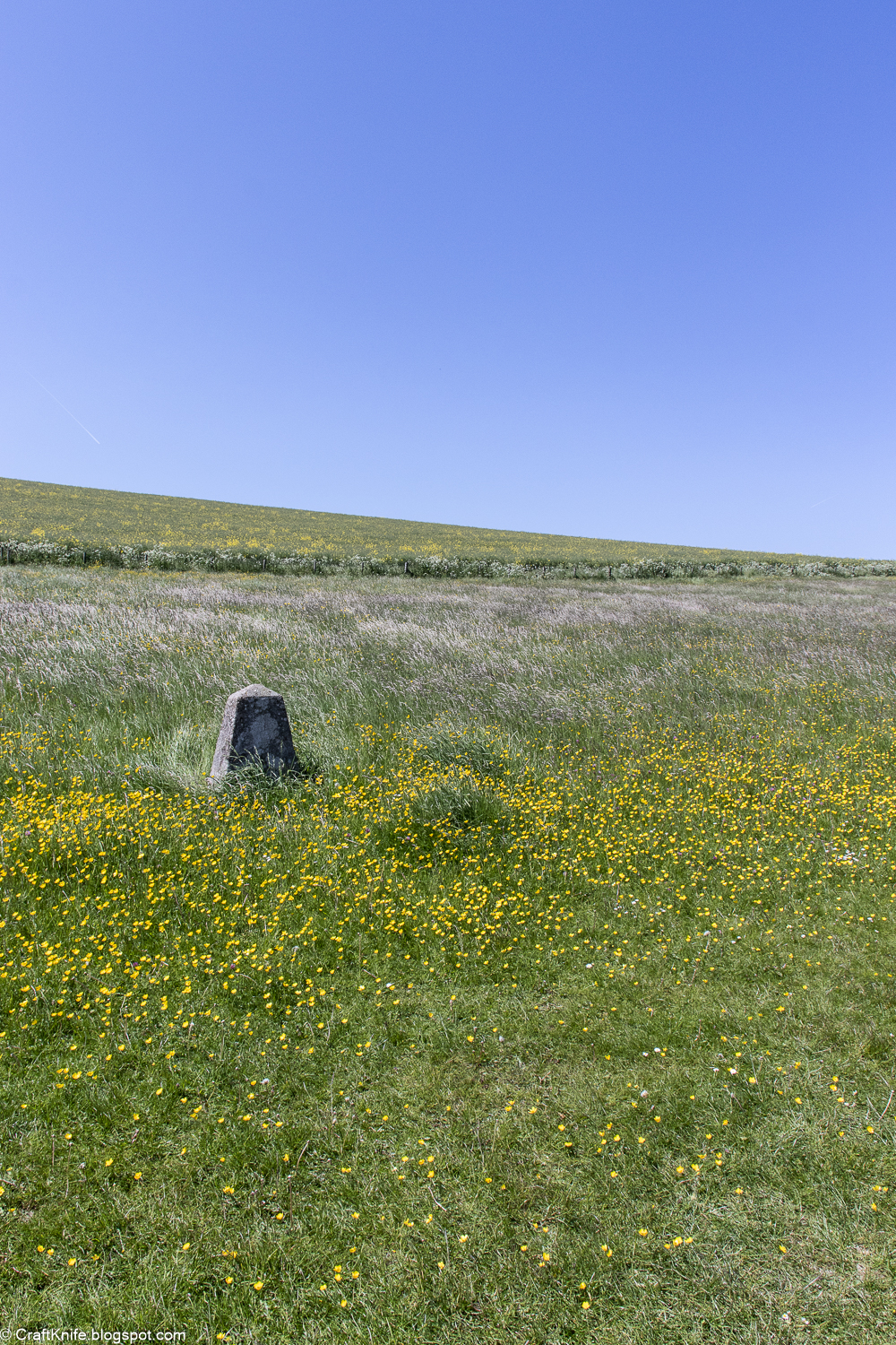
Obviously, after all that, I proceeded to insist that we had time to just take a quick swing by
Silbury Hill. I mean it was RIGHT THERE!
You guys. The Neolithic people BUILT THIS HILL. Like, it's a proper hill! A big hill! They used those red deer antler picks like the ones in the Alexander Keiller Museum. And we have no idea why!
Ugh, I just love the Neolithic peoples so much.
Next stop: Stonehenge!
- Day 1: We made it to England!
- Day 2: Westminster Abbey, National Gallery, Trafalgar Square, and Six
- Day 3: British Museum and Buckingham Palace
- Day 4: Mudlarks and Southwark
- Day 5: Natural History Museum and Victoria and Albert Museum
- Day 6: Pax Lodge, the Tower of London, and Afternoon Tea
- Day 7: Back and Forth by Boat to Greenwich
- Day 8: We Careen Our Way to Canterbury Cathedral and Dover Beach
- Day 9: Dover, Hastings, and a Holloway
- Day 10, Part 1: All the Giant Rocks
- Day 10, Part 2: Stonehenge, At Last!
- Day 11: To Avalon with King Arthur
- Day 12: Tintagel
- Day 13: In the Footsteps of Mary Anning
- Day 14: Homewards!
.jpg)
.jpg)
.jpg)
.jpg)
.jpg)
.jpg)
.jpg)
.jpg)
.jpg)
.jpg)
.jpg)
.jpg)
.jpg)
.jpg)
.jpg)
.jpg)
.jpg)
.jpg)
.jpg)
.jpg)
.jpg)
.jpg)
.jpg)
.jpg)
.jpg)
.jpg)
.jpg)
.jpg)
.jpg)
.jpg)
.jpg)
.jpg)
.jpg)
.jpg)
.jpg)
.jpg)
.jpg)
.jpg)
.jpg)
.jpg)
.jpg)
.jpg)
.jpg)
.jpg)
.jpg)
.jpg)
.jpg)
.jpg)
.jpg)
.jpg)
.jpg)
.jpg)
.jpg)
.jpg)
.jpg)
.jpg)
.jpg)
.jpg)
.jpg)
.jpg)
.jpg)
.jpg)
.jpg)
.jpg)
.jpg)
.jpg)
.jpg)
.jpg)