I don't even know how I would homeschool without a giant homemade map, y'all. We've been downloading, printing, and taping together
these huge Megamaps since
Syd was two and Will was three, and now here we are with Syd at fifteen and Will at seventeen, and we're still making and marking up giant maps.
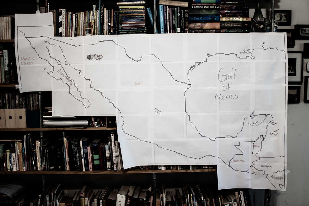
I originally printed and compiled this map of Mexico, and a separate one of North America, for my Girl Scout troop to use during our troop trip planning meetings. It was VERY amusing to unleash a troop of teenagers with a pack of markers onto a map of North America and tell them to label everything they know. Some kids eagerly took marker in hand with a gleam in the eye, and some kids hesitantly took marker in hand with a look that was more like, "Oh, shit...", but everybody was able to label something, and all efforts were praised.
They were ALL hesitant when I then presented them with this map of Mexico and the same instructions, but they gamely went to work and were eventually persuaded that they all knew a little more than they thought they did. We did have a useful conversation, though, about why it is that we don't seem to know very much about the geography of Mexico, seeing as it's just right there below us.
 |
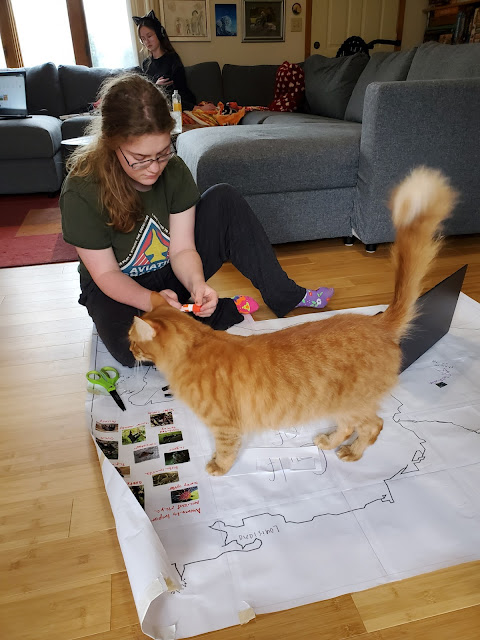
| If you look closely, you can see that placing Mexico City took them a couple of tries... |
The troop basically helped my own kiddos get a head start on what is now their map for our Mesoamerica unit study. We're studying the history, geography, geology, environment, and culture of Mesoamerica, with an emphasis on the Maya since theirs is the specific region we'll be visiting on our Girl Scout troop trip to Mexico.
But until we get to go there and look at it all in person, we have to rely on maps! This book is turning out to be the spine of our study so far:
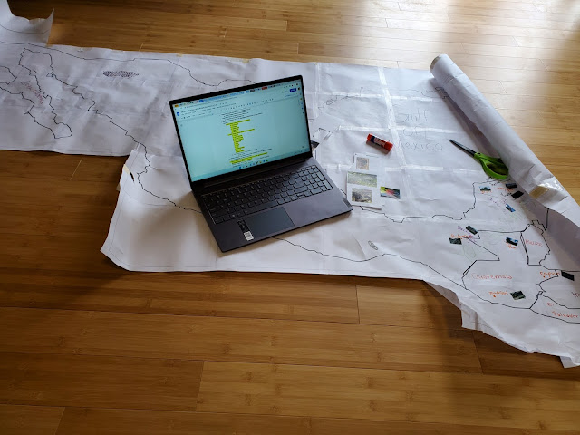
--and on this particular day, the kids transferred much of the information from Chapter 1 onto our map.
Will was in charge of finding images of the animals that were important to the Ancient Maya, then gluing them to the margin of the map and labeling them:
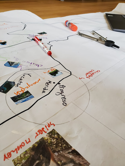
She and I also got out the compass so we could draw and label the Chicxulub Crater:
You guys, on our upcoming Girl scout troop trip, our cruise ship will be going RIGHT OVER the crater! And the cenotes that Will and I are going to snorkel in
are directly related to that impact!
Fun fact: I am both pretty sure that snorkeling in a cenote is how I die, and also definitely going to go snorkel in a cenote. Life is complicated, y'all.
Syd was in charge of the task of drawing the main rivers of Mesoamerica:
Fortunately, Jones was there to lend his assistance:
On a previous day, the kids had used the list of important places from this book--
--to map and collect images of Ancient Maya sites (I even made them write a paragraph about each site and turned them into adorable flash cards. They're so cute and I love them and the kids are absolutely horrified because they think they're too old for flash cards, my silly little geese), so those are the other little icons you can see on the map:
A lot of the map's real estate is wasted at the moment, since we're only studying Mesoamerica and not the rest of Mexico, but now that the kids are old enough to use a large-format map without utterly demolishing it in the process, I think I can hang onto this map even when we're finished and keep it for a future Syd study, at least.


No comments:
Post a Comment